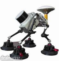
UAV Lidar Scanning system


LOCATION
S-1, 24-C, Sunset Lane No.1, Phase 2 (ext) DHA, Karachi, Dha, Karachi, Sindh, Pakistan
DESCRIPTION
Lidar scanning system is a UAV measurement system.
It highly integrates laser scanner, GNSS satellite positioning system, INS
inertial navigation system and camera (optional), and can quickly obtain high-precision laser point cloud number. It can be widely used in Digital city construction, Industry, Land survey, Forestry and Agriculture
Features
Highly integrated, High precision, 120 Meter ranging, Multi platforms, Easy operation
S-1, 24-C, Sunset Lane No.1, Phase 2 (ext) DHA, Karachi, Dha, Karachi, Sindh, Pakistan
Mention that you found this ad on DealMarkaz.pk when you call.
RELATED ADS
-
3
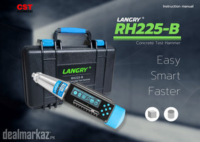
 LANGRY RH-225B Digital Concrete Schmidt Test Hammer
Digital Concrete Schmidt Test Hammer Used for testing the compressive strength o...
Trade & Industrial Equipment Karachi 2 weeks agoContact for priceView Details -
3
Yanmar (Japan) Tower Light
Yanmar (Japan) Tower Light Lamps : 4 x 400 Watts (Halogen) Lamp Type : LED Rated...
Trade & Industrial Equipment Karachi 3 weeks agoContact for priceView Details -
7
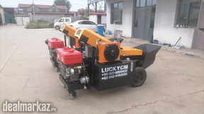
Concrete Pump Diesel Engine Driven
Mini Trailer Mounted Stationery Concrete pump Diesel Engine operated Maximum the...
Trade & Industrial Equipment Karachi 3 weeks agoRs. 2,850,000View Details -
8
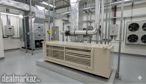
SKM Chilled Water Fan Coil Unit
High cooling efficiency with chilled water system • Low noise operation • Energy...
Trade & Industrial Equipment Karachi 1 month agoRs. 10,000View Details -
4
Water Leakage Detector
Advanced water leakage detection device widely used in buildings, residential to...
Trade & Industrial Equipment Karachi 1 month agoContact for priceView Details -
4
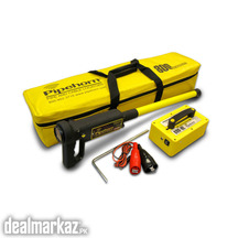
Pipe and Cable Locator (Made in USA)
Pipehorn (USA) Underground Pipe, Cable and Utility Locator 800-HL is a state-of-...
Trade & Industrial Equipment Karachi 1 month agoContact for priceView Details